Old Man River – How the Mississippi Has Changed Course Over Time
The Mississippi River Changing Course in Northern Louisiana
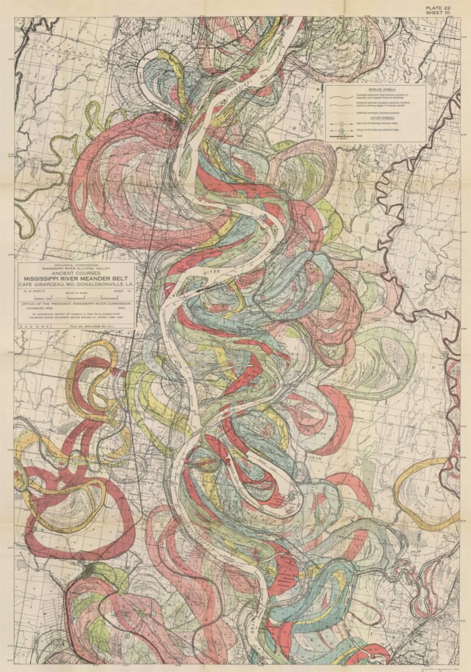
This map, produced in 1944 by a man named Harold Fisk, shows how the Mississippi River has shifted, gouged, and settled its way across Louisiana over the years. This map starts at the top right near the Louisiana-Mississippi-Arkansas border in the northeast corner of the Pelican State. The southern part of this map ends right near Vicksburg, Mississippi.
What is most impressive about these course changes, is that the northern part of Louisiana is significantly hillier and that rougher rockier terrain would make it much more difficult for the river to alter its course. Down in the delta region of south Louisiana, the river changed its course much frequently and drastically.
Of course, none of this happens any more because the Army Corps of Engineers built the levee system which keeps the river locked in its current position.